USDA opens formal review to roll back 2001 “Roadless Rule.” What El Dorado County residents should know.
PLACERVILLE, Calif. — The U.S. Department of Agriculture on Aug. 29 published a formal Notice of Intent to prepare an Environmental Impact Statement (EIS) that would lead to rescinding the 2001 Roadless Area Conservation Rule — the federal protection that for 25 years has limited new road construction and commercial timber harvest in large swaths of National Forest lands. The notice begins a short public-comment scoping period and marks the next step in a process that could affect inventoried roadless areas around Truckee-Tahoe and in El Dorado County. Federal RegisterUSDA
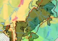
These are the IRA names and local roadless blocks that authoritative USFS maps and related USGS/Forest Service pages show inside or along the El Dorado County portion of Eldorado NF / Lake Tahoe Basin MU:


-
Dardanelles Roadless Area — south of Lake Tahoe, includes Upper Truckee headwaters and the Hawley Grade/Meiss Country corridor. (Lake Tahoe Basin Management Unit / USFS maps). WikipediaUS Forest Service
-
Freel Roadless Area — adjacent to Dardanelles (Freel Peak). (LTBMU / USFS maps). Wikipedia
-
Meiss Country (Meiss Roadless Area) — primitive, roadless area between Luther Pass and Carson Pass; shown on LTBMU pages and USFS roadless maps. US Forest Servicealllaketahoe.com
-
Roadless blocks west/southwest of Pollock Pines / Placerville — visible as clustered IRA polygons on the USFS Eldorado NF IRA map (these are part of Eldorado NF IRA inventory; see the Eldorado NF IRA map PDF). US Forest Service
-
Mokelumne Wilderness and adjacent roadless areas (Tragedy–Elephants Back, Caples Creek, etc.) — these roadless blocks lie to the south/southwest of Carson Pass and span county boundaries; USGS and USFS mapping identify these areas and contiguous roadless polygons. USGSUS Forest Service
Note: the USFS national IRA geodatabase contains every polygon with attribute fields (forest, name, acres, category). That is the definitive source for exact polygon geometry and attribute names.
Key facts, timeline and how to comment
-
The Federal Register notice (the formal record) was posted Aug. 29, 2025; the scoping comment period runs to Sept. 19, 2025. Comments should be submitted to docket FS-2025-0001 on Regulations.gov. Federal RegisterRegulations
-
Nationwide, the Forest Service’s inventories show roughly 58.2 million acres of inventoried roadless areas; about 44.7 million acres are currently governed by the 2001 Roadless Rule. Rescinding the rule would restore discretion over road construction and timber harvest on those lands. Federal RegisterUSDA
-
Local maps and Forest Service documents show tens of thousands of roadless acres in the Truckee–Tahoe region and in El Dorado County — for example, the Lake Tahoe Basin Management Unit’s maps list roughly 41,000 acres of inventoried roadless area, and Forest Service roadless maps for Tahoe and Eldorado national forests identify additional large IRA (Inventoried Roadless Area) blocks near the Tahoe basin and around Placerville. Residents can view those agency maps on the Forest Service website. US Forest Service+2US Forest Service+2
What would change — and what would remain
-
What could change: If the rule is rescinded, new or reconstructed permanent roads and larger commercial timber projects could be proposed in areas previously constrained by the 2001 rule — subject to project-level analyses under NEPA. USDA leaders say the change is intended to give local forest managers more options for fuels treatment and wildfire response. USDA
-
What would not automatically change: Rescinding the Roadless Rule would not erase wilderness designations, Endangered Species Act protections, water-quality laws, tribal consultation obligations, or the requirement for site-specific environmental review before major projects proceed. Those other statutory safeguards remain in place, though their outcomes would shape any future project approvals. Federal RegisterUSDA
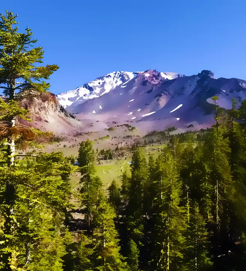
Local stakes: Tahoe Basin, Eldorado National Forest, recreation and water
Roadless lands around the Lake Tahoe Basin — including backcountry near Freel Peak, portions of the Tahoe Rim Trail and headwaters that feed the upper Truckee — are cherished for recreation, wildlife habitat and watershed protection. Conservation groups warn that new roads can fragment habitat, increase sediment and erode water quality that communities depend on. Local reporting and Forest Service maps make clear those places are among the inventoried roadless areas at issue. Tahoe Daily TribuneUS Forest Service
Voices on both sides
“This is one step closer to common-sense management of our national forest lands,” Agriculture Secretary Brooke L. Rollins said in the department’s announcement, arguing the change will restore local decision-making and help reduce wildfire risk. USDA
Environmental groups offered sharp criticism. “This is a direct attack on the heart of California’s forests,” said Mark Green, executive director of CalWild, calling the short comment window insufficient and warning about threats to drinking water, wildlife and recreation. The Wilderness Society called the move “the single largest rollback of conservation protections in our nation’s history” and said litigation is likely. CALWILDThe Wilderness Society
What to watch next (short timeline)
-
Scoping / public comments (now through Sept. 19, 2025). Submit comments to FS-2025-0001 at Regulations.gov. Regulations
-
Draft EIS & proposed rule — the agency has signaled the draft is expected in early 2026 (local reporting cites a March 2026 target) with a final EIS and Record of Decision expected later in 2026; expect both more public comment opportunities and likely legal challenges. Tahoe Daily TribuneUSDA
How El Dorado County residents can act now
-
Review the Forest Service roadless maps for Lake Tahoe Basin, Tahoe NF and Eldorado NF (agency PDFs and GIS layers). US Forest Service+2US Forest Service+2
-
Submit a comment to Regulations.gov, docket FS-2025-0001 (search that docket number on Regulations.gov). Comments submitted during the scoping period will help shape the alternatives the Forest Service analyzes in the draft EIS. Regulations
-
Contact your county supervisors or state legislators to register local concerns about water, recreation, wildfire strategy, or community access.


