By Cris Alarcon, InEDC Writer. Feb 13, 2026)
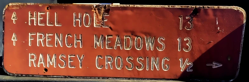
A badly weathered plywood roadside sign believed to date to the 1970s and referencing Sierra destinations including Hell Hole and French Meadows has resurfaced, prompting a wave of local reaction across El Dorado County and nearby foothill communities.


The sign was posted publicly this week by local resident James Fischer, who described it simply as a “New find picked up today. 70s I believe.” estimating its age at roughly five decades. Community members quickly identified the marker as one that once stood near the Ramsey Crossing area and road junctions serving the high-country reservoir corridor.
Multiple commenters with road crew and recreation ties said the sign previously stood near the intersection of Ramsey Crossing Road and Tiger Roll Road, while others recalled similar signage along Eleven Pines Road and Forest Service routes during major dam and access road construction in the 1960s through 1980s. Several residents connected the sign to travel routes serving both Hell Hole Reservoir and French Meadows Reservoir.
The reservoir corridor referenced on the sign is part of the Middle Fork American River Project, a major hydroelectric and water supply system developed in the 1960s and operated by the Placer County Water Agency. While frequently associated with El Dorado County due to access routes and recreation patterns, the system was authorized by Placer County voters and built to provide water and power for foothill and valley communities.
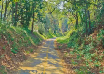
Construction of the project began in 1963 and included remote road building, tunneling and dam works across rugged Sierra terrain within and near the Eldorado National Forest. Oral histories from residents and former workers describe rock crushing, blasting and haul-road development into the Hell Hole basin and French Meadows region.
The Hell Hole site is also known for the December 1964 construction-era dam failure, when extreme flooding overtopped an unfinished structure and sent a destructive surge downstream, damaging bridges and infrastructure before flows were contained by downstream reservoirs. The dam was rebuilt and completed in 1966, with the full project entering operation in 1967.
Some commenters questioned how the original sign was removed, with one writing, “I wondered where it went.” No official record of removal or replacement has yet been cited by transportation or forest officials.
The sign’s exact origin, installation date and removal timeline remain unverified. Local historians say older road and destination markers tied to dam construction and early recreation mapping are increasingly scarce, making documentation important.


