Red Flag Warning Issued
EL DORADO COUNTY, Calif. — Residents in eastern El Dorado County and communities near the Sierra crest should prepare for a significant increase in fire-weather conditions Saturday as the National Weather Service has upgraded a Fire Weather Watch to a Red Flag Warning.
The warning issued by the National Weather Service in Reno is in effect from 11 a.m. Saturday, Sept. 12, through 2 a.m. Sunday, Sept. 13, for the Northern and Southern Sierra Front. The affected region includes the Northern Sierra Front and Southern Sierra Front, with the warning extending across portions of eastern California and western Nevada.

The National Weather Service said the warning was issued because of the combination of gusty winds and low humidity.
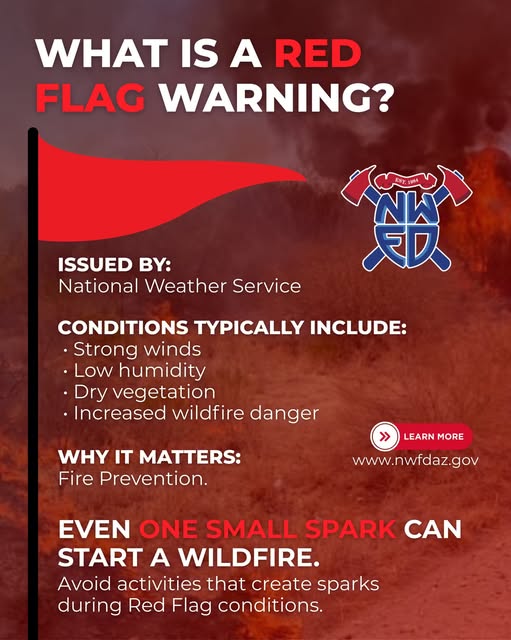
“The combination of strong winds and low humidity can cause fire to rapidly grow in size and intensity before first responders can contain them,” the National Weather Service said in its warning.
Winds could reach 50 mph
Forecasters are calling for southwest winds generally between 20 and 30 mph, with gusts reaching 50 mph. Wind-prone locations along U.S. 395 could experience gusts as high as 65 mph.
Relative humidity could fall to approximately 12%, creating an especially dangerous combination when paired with strong winds and dry vegetation. The most critical conditions are expected to develop Saturday and continue into the overnight hours.
For El Dorado County residents, the warning is particularly relevant to the county’s eastern reaches, including the South Lake Tahoe area and higher elevations along the Sierra. National Weather Service forecast zones operated by the Reno office include eastern El Dorado County, and South Lake Tahoe Airport is identified within that forecast area.
The Reno forecast office’s Friday morning discussion described Saturday as the peak wind period, with gusty conditions expected to begin increasing early in the day and persist into the overnight hours.
Fire danger rises when wind and humidity combine
A Red Flag Warning does not mean a wildfire is occurring. It means weather conditions are favorable for rapid fire ignition and spread if a fire starts.
That distinction is important in a county such as El Dorado, where communities transition quickly from developed areas into heavily forested and brush-covered terrain.
The National Weather Service recommends avoiding activities that could create sparks near dry vegetation, including outdoor burning, certain yard work, target shooting and campfires. Residents should also follow all current local fire restrictions.
The agency recommends preparing before the strongest winds arrive by securing loose outdoor objects and making sure emergency supplies are available. Residents should have adequate food and water, flashlights and spare batteries available in case wind-related damage results in power outages.
Sierra conditions warrant attention even outside the warning area
The warning comes as a broader weather pattern brings increasingly strong winds across Northern California and the Sierra.
The National Weather Service office in Sacramento has separately issued a Red Flag Warning for portions of the Sacramento Valley and northern Sierra foothills from 11 a.m. Saturday through 11 a.m. Monday, citing gusty winds, low daytime humidity and poor overnight humidity recovery.
That warning is distinct from the Reno-issued Sierra Front warning, but together the advisories underscore the broader fire-weather concern developing across Northern California this weekend.
For El Dorado County residents, conditions can vary substantially with elevation and location. A relatively calm afternoon in Placerville or the western foothills does not necessarily mean conditions will be the same in the higher elevations or around the Tahoe Basin.
Residents urged to prepare before Saturday
With the strongest winds expected Saturday, fire officials and weather forecasters are urging residents to take precautions before conditions deteriorate.
Residents should avoid creating ignition sources around dry vegetation, secure outdoor furniture and other loose objects, and keep vehicles, equipment and property prepared for changing conditions.
Anyone who sees a wildfire or column of smoke should report it immediately rather than assuming someone else has already called it in.
The National Weather Service advises residents to monitor updated forecasts and official emergency information as conditions develop Saturday.
For the latest weather watches, warnings and fire-weather information, residents can monitor the National Weather Service Sacramento office and National Weather Service Reno office.
Editor’s note: The Red Flag Warning described in this article is specifically the National Weather Service Reno warning for the Sierra Front. It should not be interpreted as a blanket Red Flag Warning covering all of El Dorado County; weather and fire-weather conditions can differ significantly between western El Dorado County, the foothills, the Sierra crest and the Tahoe Basin.