Placerville weather forecast: Cooler temperatures and possible Monday showers
PLACERVILLE, CALIFORNIA
72°–82°F
Expected daytime highs Sunday through Thursday, with a brief dip Monday



Forecast updated Oct. 9, 2026, at 10:50 p.m. PDT. Conditions may change.
Placerville residents can expect a noticeable cooldown this weekend, a chance of showers Monday and a return to sunnier weather during the middle of next week, according to the latest forecast data available Friday night.
The most significant change is expected Monday, Oct. 12, when daytime temperatures are forecast to reach about 67 degrees. The forecast indicates an 84% chance of precipitation during the day, with showers possible around midday and again in the evening.
For residents planning outdoor activities, the forecast suggests Saturday and Sunday will offer more favorable conditions, while Monday may require a backup plan.
Placerville’s day-by-day forecast

Saturday, Oct. 10
Mostly sunny; pleasant afternoon
75° / 47°F
Rain chance: 0% daytime

Sunday, Oct. 11
Sunshine with some clouds
72° / 49°F
Rain chance: 19% daytime

Monday, Oct. 12
Cooler, cloudy, with possible showers
67° / 49°F
Rain chance: 84% daytime

Tuesday, Oct. 13
Mostly sunny and cool
70° / 52°F
Rain chance: 5% daytime

Wednesday, Oct. 14
Sunny and warming
74° / 52°F
Rain chance: 5% daytime

Thursday, Oct. 15
Sunny and warmer
82° / 55°F
Rain chance: 3% daytime
Forecast highs, lows and precipitation probabilities are approximate and can change with updated forecasts.
Will it snow in Placerville or the Sierra Nevada?
Snow is not expected in Placerville during the Oct. 10-15 forecast period. The projected daytime highs, including temperatures in the 70s and low 80s later in the week, are far too warm for accumulating snow at the city’s elevation under the forecast conditions.
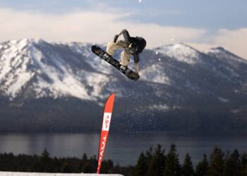
The outlook is different at higher elevations. The Sierra Nevada can experience early-season snowfall when colder air combines with incoming Pacific storms. Whether snow develops depends on the storm track, the amount of cold air available and the snow level — the elevation above which precipitation falls as snow.
Residents traveling toward South Lake Tahoe, Echo Summit or higher mountain passes should check the forecast for their specific destination rather than relying on conditions in Placerville. Early-season storms can bring rapidly changing mountain weather, even when the foothills remain mild.
For official mountain forecasts and road conditions, consult the National Weather Service in Sacramento and Caltrans QuickMap.
Could El Niño change El Dorado County’s winter weather?
The answer is yes. El Niño can influence California’s winter storm patterns, but it cannot tell us exactly when Placerville will receive rain or whether a particular Sierra storm will produce snow.
In its Oct. 8 assessment, the National Oceanic and Atmospheric Administration’s Climate Prediction Center reported that El Niño continues to strengthen. The agency said there is greater than an 83% chance that a strong-to-very-strong event will persist through January-March 2027.

El Niño develops when sea-surface temperatures in parts of the tropical Pacific become warmer than average, changing atmospheric circulation and influencing storm tracks around the world.
For Northern California, the important question is how those changes affect the position of the Pacific jet stream and the frequency, intensity and direction of winter storms.
A strong El Niño can increase the likelihood of wetter conditions in parts of Southern California and the southern United States. Northern California’s response is less uniform, and local outcomes depend on the broader atmospheric pattern.
NOAA’s forecast discussion also cautions that even a strong El Niño does not guarantee that every region will experience the expected impacts.
For El Dorado County, three potential effects deserve attention:
-
More opportunities for heavy rain: If Pacific storms repeatedly reach the foothills, periods of heavy rainfall could increase concerns about localized flooding, drainage problems and runoff.
-
Potentially significant Sierra snowfall: Strong winter storms can deliver substantial mountain snow, but snow levels and temperatures will determine how much falls as snow rather than rain.
-
A greater need to monitor storm timing: Atmospheric rivers and other winter systems can affect highways, mountain travel and local waterways. El Niño alone cannot determine which storms will reach the county.
The important distinction is that El Niño changes probabilities over a season. It does not provide a reliable day-by-day forecast months in advance.
What El Dorado County residents should watch next
The coming week’s weather looks relatively straightforward: mild weekend conditions, a possible wet spell Monday and a return to sunshine. The larger uncertainty concerns the winter season ahead.
Residents should watch for updated seasonal precipitation outlooks, changing snow-level forecasts and official storm advisories as the Pacific storm season develops.
The National Weather Service’s Sacramento office provides forecasts and warnings for the western foothills, while its Reno office covers much of the Lake Tahoe region. Conditions can differ substantially between Placerville and the Sierra crest.
Useful official resources include:
Bottom line: Placerville is not expected to see snow next week, and Monday is the main day to watch for showers. A strengthening El Niño makes the upcoming winter especially worth monitoring, but the amount of rain in the foothills and snow in the Sierra will depend on the actual storms that develop.