A Hotel at the Top of the Sierra
For motorists traveling U.S. Highway 50 through eastern El Dorado County today, Echo Summit is familiar territory — a high Sierra pass where the highway climbs above the tree line before beginning its descent toward Lake Tahoe.
More than 150 years ago, however, reaching the same general mountain country was a very different proposition.
There was no modern highway. There were no paved roads, guardrails or snowplows. Travelers heading between California and the settlements and mining camps east of the Sierra depended on a rugged network of wagon roads and trails collectively associated with the Placerville Route.
And near the summit stood the North American Hotel.
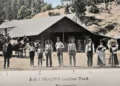
An extraordinary 1866 photograph by Lawrence & Houseworth documents the building. The Library of Congress catalog identifies the image as North American Hotel — on the western summit, Placerville Route, Calif. and places it within the publisher’s Gems of California Scenery series. The Library notes that its collection contains one photograph from a stereographic pair and cautions that some catalog information was transcribed from an older caption card and remains unverified.
That qualification is important to anyone trying to place the building precisely on a modern map.
The Route Before Highway 50
The road through this part of the Sierra was closely associated with John Calhoun “Cockeyed” Johnson, who explored a trans-Sierra route during the early 1850s.
The route became known as Johnson’s Cutoff and, in time, the Placerville Route. It connected the Placerville area with the Lake Tahoe Basin and routes leading into Carson Valley. Historical accounts describe the trail climbing toward what is now called Echo Summit before descending toward the South Fork of the American River.
The National Park Service’s historical study of the Pony Express provides an important distinction. It identifies an earlier California route that crossed Echo Summit and a later route over Johnson Pass that shortened the journey. Both ultimately connected with the South Fork corridor and Placerville.
That history helps explain why modern references to Echo Summit, Johnson Pass and the Placerville Route can sometimes appear interchangeable even though the historic routes changed over time.
What the Photograph Tells Us
The North American Hotel photograph is more than a picture of an old building.
It captures a moment when the Sierra summit itself was part of the travel experience.
The image shows a relatively simple mountain structure standing amid a landscape that would have been immediately recognizable to travelers of the period: massive trees, exposed rock and the high-country environment of the Sierra Nevada.
The photograph was produced during the era of the stereograph, a popular 19th-century technology that used two slightly different images to create a three-dimensional effect when viewed through a stereoscope.
Lawrence & Houseworth were prominent California photographers and publishers, and their stereographs documented much of the state’s developing landscape. The Getty Museum also holds a related Lawrence & Houseworth photograph titled North American Hotel, on the Summit of Sierra Nevada, dated 1865.
The University of California’s Calisphere likewise catalogs 636. North American Hotel, On the Summit of Sierra Nevada, identifying Lawrence & Houseworth as the publisher and dating the image to the 1860-1870 period.
Together, the surviving photographic records demonstrate that the hotel was not merely a passing reference in a traveler’s diary. It was significant enough to be included among the scenic attractions being commercially photographed and distributed across the country.
A Mountain Highway Before Automobiles
The significance of the location becomes clearer when viewed against the transportation history of El Dorado County.
Placerville was the western gateway to the Sierra and became an important staging point for travelers heading toward Lake Tahoe, Carson Valley and the Nevada mining country.
The route carried emigrants, freight wagons, stage traffic, mail and travelers drawn eastward by the explosive growth of the Comstock mining region.
The Pony Express also used the broader Placerville-Carson corridor during its brief existence in 1860 and 1861. Historical accounts identify the route through the Sierra as part of the network connecting Placerville with the Nevada territory.
A hotel at the summit therefore served a practical purpose. In an era when a journey across the Sierra could be arduous and dangerous, a structure offering shelter at or near the crest was far more consequential than a roadside motel is today.
For a traveler arriving after a difficult climb, the sight of the North American Hotel would have meant shelter, warmth and a chance to rest before continuing across the mountains.
Echo Summit Today
The landscape has changed dramatically.
Modern travelers cross the Sierra on U.S. Highway 50, a major transportation artery connecting the Sacramento region with South Lake Tahoe and the Nevada border.
Caltrans identifies Echo Summit as part of the modern Highway 50 corridor in El Dorado County. The present highway alignment is the product of 20th-century engineering rather than a simple continuation of the original wagon road.
Even the name of the summit reflects the evolution of the route.
Historical accounts refer to the area as Johnson’s Summit or Johnson Pass, while the modern highway crosses Echo Summit. Johnson Pass Road remains an important remnant of the older transportation landscape and has been used as an alternate route during major Highway 50 closures. Caltrans specifically identified Johnson Pass Road as a detour during its 2020 Echo Summit bridge project.
The El Dorado County region also contains officially recognized historic resources associated with the area’s transportation history. The county’s current hazard mitigation plan lists the Site of Echo Summit as a California State Historical Landmark.
A Lost Hotel, a Surviving Photograph
There is an important lesson in the North American Hotel story.
Historic places do not always survive as buildings.
Sometimes they survive as photographs, maps, newspaper accounts and the names left behind on modern roads.
The North American Hotel appears to have vanished from the physical landscape long ago. But its 1860s image remains preserved in major photographic collections, including the Library of Congress, Getty Museum and University of California’s Calisphere.
For residents of El Dorado County, the photograph provides a remarkable window into a landscape that can otherwise be difficult to imagine.
The next time motorists crest Echo Summit, they can look beyond the pavement and modern highway infrastructure and consider what stood there before the automobile.
Before Highway 50, before modern snow removal and before the roar of interstate traffic, travelers climbed the Sierra by wagon road.
At the summit, the North American Hotel stood as a landmark on that journey.
Its walls are gone.
The route remains.
And the photograph still tells the story.
Historical Source Note
The strongest primary-source evidence for the North American Hotel is the 1866 Lawrence & Houseworth stereograph preserved by the Library of Congress. The Library’s own catalog identifies the image as being on the “western summit” of the Placerville Route but explicitly notes that portions of its old caption-card information are unverified. For that reason, the hotel’s identification with the broader Echo Summit/Johnson Pass landscape is historically well supported, but an exact modern parcel or GPS location should not be stated as certain without additional primary-source mapping evidence.
Primary historical references:
Library of Congress — North American Hotel, Placerville Route, 1866
Getty Museum — North American Hotel, on the Summit of Sierra Nevada
Calisphere — North American Hotel, On the Summit of Sierra Nevada
Caltrans — Echo Summit historic highway documentation